Command the fight from anywhere.
Give commanders one live operating picture that works forward, disconnected, or on the move — fusing sensors into a single track picture, connecting command to the field, and keeping the force protected. It runs at the tactical edge with no cloud to reach back to.
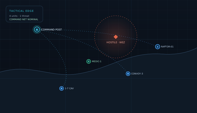
The picture breaks exactly where the mission is hardest.
At the tactical edge, connectivity is intermittent, sensors are heterogeneous, and the tools that work in a garrison operations center assume a cloud that isn't there. Commanders end up stitching a picture together by voice and chat while the situation moves faster than the map.
What's needed is a common operating picture that fuses every available feed into one trustworthy track picture, pushes orders to the field and pulls reports back — and keeps doing it when the network is degraded or denied.
- One live operating picture — 2D/3D map with own-force units, telemetry, trails and replay.
- Sensor fusion at the edge — radar, EO/IR, ADS-B and more fused into confidence-scored tracks.
- Two-way Command Net — orders with receipts, plus field messaging in text and voice.
- Force protection — threat WEZ rings and proximity alerts to units in range.
- MEDEVAC & force health — 9-line lifecycle and live vitals-driven readiness.
- Runs disconnected — self-hosted on a forward node; no cloud dependency.
A forward command post, degraded comms
The following is an illustrative deployment pattern — not a specific customer engagement.
1 · Stand up in the enclave
Command Center installs on a ruggedized node at the CP. No accounts to provision with a cloud, no external services to reach — it's live on the local network in minutes.
2 · Fuse the feeds
Local radar, a UAS EO/IR feed and ADS-B post detections to the open ingest contract. The correlator de-duplicates them into one track picture; a confirmed hostile auto-surfaces for triage.
3 · Command to the field
The commander issues a FRAGO over the Command Net; subordinate elements acknowledge from the field tablet, mark a threat, and request MEDEVAC — all reflected live on the map.
See it against your scenario.
We'll walk your team through a live picture on synthetic data shaped to your mission.